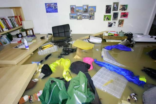
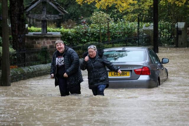
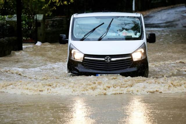
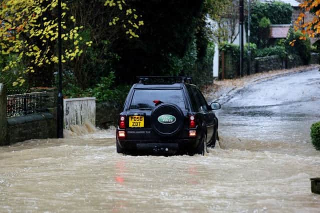
Shocking photographs of homes and roads flooded in Yorkshire as rain batters county amid amber weather warnings
Residents battled through the floods to attempt to save their homes, with many main roads including the Parkway in Sheffield closed due to standing water.
In Leeds, The Flood Information Service warned that flooding is possible in areas - urging residents to 'be prepared'.
Advertisement
Hide AdAdvertisement
Hide AdRiver levels are rising in the Middle River Aire catchment, which covers the expanse of river from Hunslet in Leeds towards Castleford.

The flood alert said: "River levels are rising steadily in response to persistent rainfall.
"Consequently, flooding of roads and low-lying land is possible from this morning until approximately 9am tomorrow.
"Areas most at risk are low-lying areas. Flooding of properties is not forecast at this point."
Advertisement
Hide AdAdvertisement
Hide AdFurther downpours are forecast over the next 24 hours and the Met Office has issued a yellow weather warning for rain.
There is a 90% or higher chance of rain for the remainder of the day in Leeds, with temperatures not expected to increase from around 8 degrees.
Sheffield saw the worst of the flooding in the region, with an amber warning set for the entirety of the day.
Dramatic photographs show some residents escaping their cars which were consumed by rain.
Advertisement
Hide AdAdvertisement
Hide AdThe amber warning states: “Persistent, heavy rain will affect the area during Thursday and much of Thursday night, before slowly dying out on Friday morning.
“40 to 60 mm is likely to fall quite widely, with 80 to 100 mm possible over high ground.”
Chief Meteorologist Neil Armstrong said, “With a weather front from the latest low-pressure system effectively stalling over the north of England there will be a period of heavy and sustained rainfall through Thursday in the north of England.
"With the possibility of up to 100mm of rain falling on already saturated ground there could be some significant disruption.
Advertisement
Hide AdAdvertisement
Hide Ad“A strengthening north-easterly wind will make it feel even more unpleasant. Take extra care if you are travelling and keep up to date with the Met Office forecast for the latest information.”
The warnings cover both the morning and evening rush hours, with transport expected to be disrupted.
RAC spokesperson Simon Williams said: “Drivers in the worst affected areas will need to exercise caution as visibility will be severely reduced while stopping distances are likely to be greatly increased.
“The best advice is to slow down and leave more space behind the car in front to give more time to react to anything that might happen.
Advertisement
Hide AdAdvertisement
Hide Ad“If you encounter any floods be very conscious of not driving through water that is too deep as this could very easily lead to catastrophic damage.
“Try to assess the depth by looking at the kerb or road signs and, if you decide it’s safe to go through, drive at a steady speed so as not to create a bow wave, and try to use the highest part of the road.
“If there is any doubt, then it’s probably best to turn around and take another route.”
The warning in Sheffield is in force until 3am on Friday.